The Trolleybuses of
M É R I D A
Venezuela
BY
Allen Morrison
Cities with complex geography – mountains, valleys, steep grades, rivers, airports in the center of town
– have special traffic problems. The city of Mérida and
Alberto Carnevali Airport straddle a long, narrow plateau between two
river valleys high in the Andes Mountains [NASA]: |
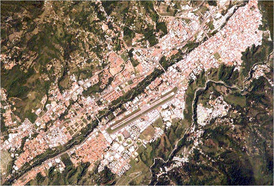
The
airport runway in the center of this satellite view is 1,373 m long and
lies at altitude 1,526 m. Only two streets go around it. Private homes,
shops and other structures crowd the edge of the precipice that drops
150 m toward the Chama River on the right. The Teleférico de Mérida,
the world's longest and highest aerial cableway and the principal
tourist attraction in Venezuela, climbs from a point nearby to Pico
Espejo at 4,765 m. Pico Bolívar next to it, at 4,981 m, is the
highest mountain in Venezuela. Mérida's population today is
about 400,000. It may be the smallest city in the world with a mass transport system.
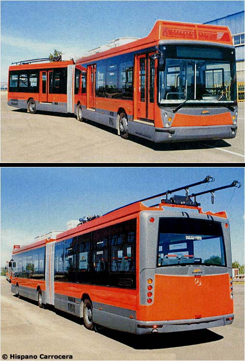
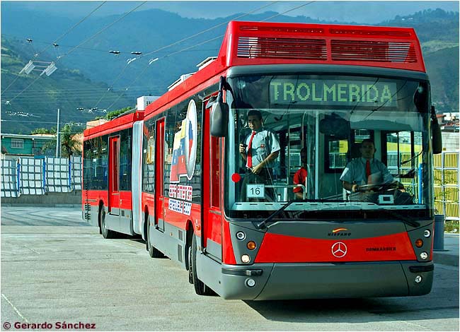
Mérida was never connected with the rest of Venezuela by railroad and never had a tramway of any kind. Urban and interurban transportation were always provided by gas- or diesel-powered buses. When traffic along the plateau reached the saturation point in the 1970s, the local government created the Oficina de Transporte to try to solve the city's transport problems. In 1976 the Oficina proposed an aerómetro, an elevated railway, from Mérida to Ejido, a suburban town 11 km southwest [see map]. It was not built. In 1983 engineers at Universidad de Los Andes proposed a ferrocarril magnético called "Telmagv" across the city. Nothing came of that plan. In 1996 the administration formed the Oficina Metropolitana de Transporte Masivo (OFIMETRO) which acquired $60 million from the federal government for the construction of a 13 km monorriel along the south bank of the Albarregas River. That plan also collapsed. Finally, in 1998, Ofimetro proposed a reserved-lane trolleybus system modeled on the very successful line that had opened in 1995 in Quito, Ecuador. Ofimetro wanted two trolleybus lines on either side of the Albarregas River and a funicular railway down the escarpment to San Jacinto in the valley. For its main lines, the trolebús was the technology that was chosen and is still being implemented in Mérida today. (See Ofimetro logo.) A new agency called Transmérida, organized in 1999, secured a USD $108 million loan from the Spanish, French, German and Dutch governments for the construction of 45 articulated trolleybuses and the first trolleybus line, a 19 km route between Ejido and La Hechicera [see map]. A consortium of DYCVENSA and Grupo AM of Venezuela, Adtranz (DaimlerChrysler) of Germany, Mercedes-Benz España, the Spanish firm Dragados and Systra of France was organized to build the line. The contract for the construction of the 45 vehicles was awarded to the companies that had supplied 113 trolleybuses to Quito: Hispano Carrocera and Mercedes-Benz of Spain. Pininfarina of Italy designed the vehicle bodies, inside and out. Electrical equipment was originally supposed to be supplied by Kiepe Elektrik of Germany, but ultimately came from Bombardier of Canada. Here are photographs of the Mérida prototype vehicle (see paper model by Rodolfo Cammalleri). Note that it has doors on only one side and they are designed for high-level, platform loading. The trolleybus can operate electrically or by using an auxiliary diesel motor [Hispano Carrocera]:
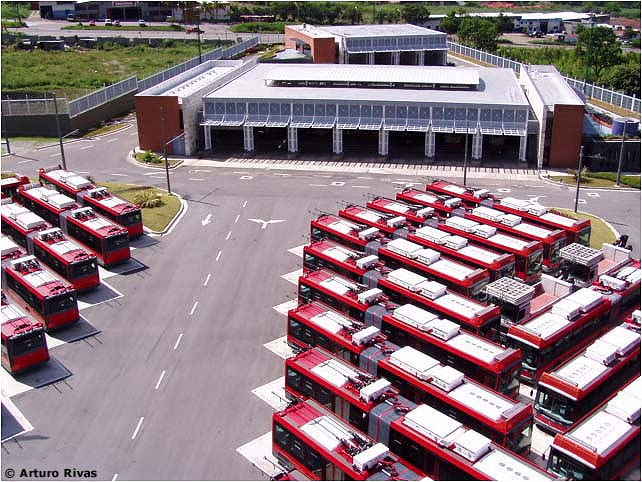
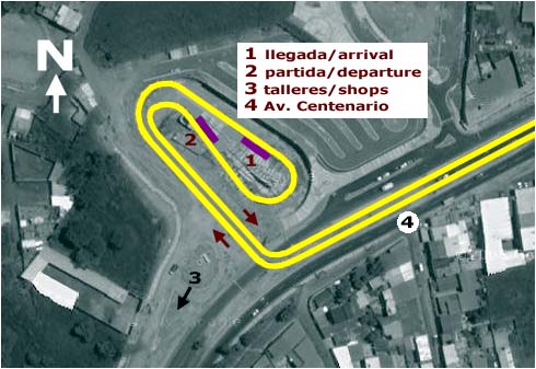
Construction of Mérida trolleybus line #1 began in February 2000 and was immediately beset with problems. The Ofimetro project was rejected, then supported, then rejected again by the federal government. Financing was erratic and work was interrupted for long periods. Motorists complained of disruptions along the Av. Centenario - Av. Andrés Bello corridor, the only direct route between Ejido and Mérida [see map]. They became angrier still when its traffic lanes were rebuilt as reserved lanes for trolleybuses. The trolleybus company was reorganized and renamed Trolmérida, but progress remained slow. Both Ofimetro and Trolmérida posted webpages on the Internet, but none was kept current or did much to establish good relations with future passengers. Construction of the vehicles, however, kept on schedule and Hispano Carrocera delivered 45 trolleybuses to Mérida between May and July of 2003. The photographs below show the Trolmérida shops in Ejido [see map]. The posts and overhead wire visible in the first view are part of a vía de prueba (test track) around the yard. There is no wire connection between the yard and the trolleybus line. The vehicles use their diesel motors to reach Terminal Ejido. Engineer Arturo Rivas scaled a 25 m light tower to get the first picture . . . [Arturo Rivas, Trolmérida]:
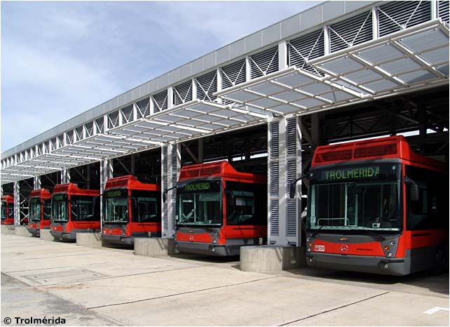
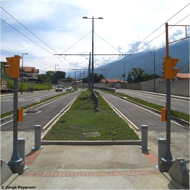
The government restored its support and finally, in 2005, after over five years of construction, Trolmérida completed the first 6.5 km of its trolleybus line between Ejido and Mérida [see map]. Except at level crossings the route is entirely in vías exclusivas, and since the stations are between the trolleybus lanes and the vehicles have doors on only the right side, they run left-hand, English-style, against other traffic. This photograph was taken from a station on Av. Andrés Bello [Jorge Paparoni]:
An unidentified station on Av. Andrés Bello, before service had begun. Trolleybuses will come forward in this lane [Jorge Paparoni]:
|
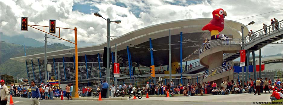
| Terminal
Ejido was designed by Venezuelan architect Roberto Ameneiro, who also
designed Alto Chama station [see below] and six stations of the metro
in Valencia, Venezuela. The view is north [see map].
The trolleybus line follows Av. Centenario on the right. "Guaky", the
red macaw on the pillar, was the mascot of Copa América 2007,
the fútbol (soccer) tournament that began the
following week in stadiums throughout Venezuela. The two photographs
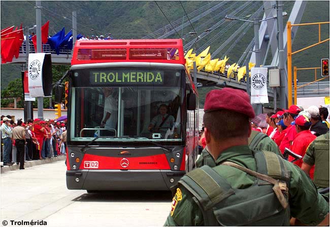
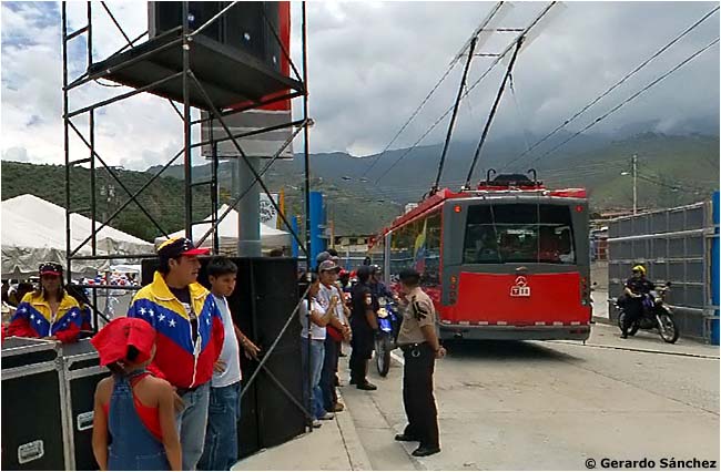
below show the trolleybus inauguration [Trolmérida website]:
This second picture was copied (with permission) from a 360° panoramic view taken that famous day by Gerardo Sánchez:
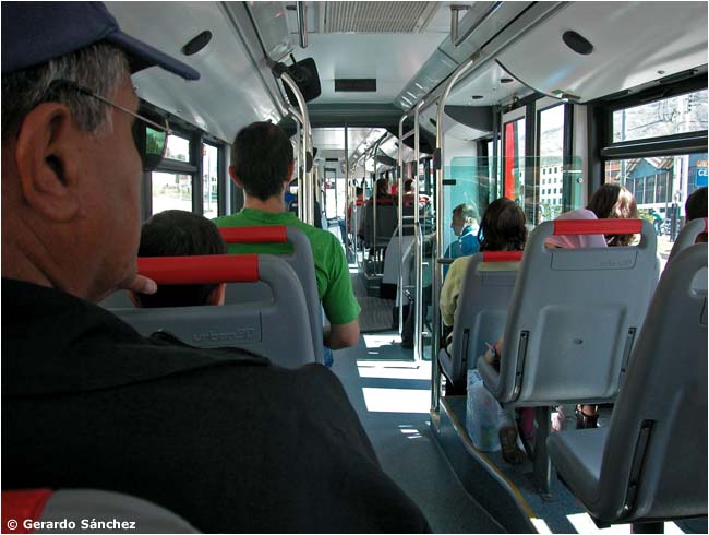
Inside a Trolmérida trolleybus [Gerardo Sánchez]:
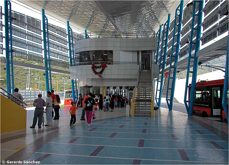
The photograph below shows Terminal Ejido during the Christmas holidays, 2007. The view is northwest [see map
and diagram below]. The trolleybus on the right has deposited its
passengers in the terminal. Passengers in the distance are clearing
turnstiles (rides were still free) to board the trolleybus partly
visible on the left. Trolmérida has offices and a control tower
overhead. The stairway on the left leads to a pedestrian bridge over
Av. Centenario [Gerardo Sánchez]: |
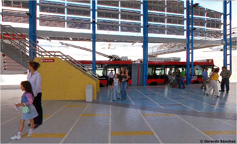
Passengers leaving a trolleybus that has just arrived. This is another image copied from a 360° panoramic view by Gerardo Sánchez: |
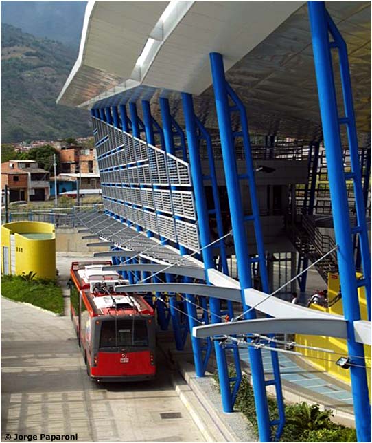
The departure area at Terminal Ejido [see map] [Jorge Paparoni]:
Diagram of the wire layout at Terminal Ejido, superimposed on a satellite view from about 2005, which showed the building still under construction [compare map]. Trolleybuses going to/from the shops use their auxiliary diesel motors [Google Earth, AM]:
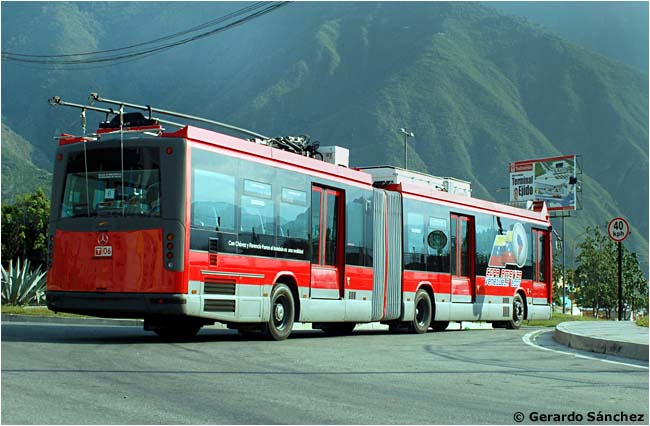
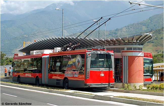
The trolleybus in the picture below has its poles down and has either just arrived at Terminal Ejido or is preparing to leave there, using its diesel motor, for the garage [see map]. Note the Hispano, Mercedes and Bombardier logos below the window. The apparatus on the wires in the distance helps the trolleybus reattach its poles [Gerardo Sánchez]:
The same trolleybus. The foothills of the Andes [Gerardo Sánchez]:
|
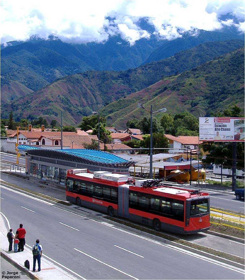
Looking west at Alto Chama station [see map]. The sign on the post, to the left of the trolleybus, is the same seen in the preceding photograph [Gerardo Sánchez]:
Two trolleybuses pass at Alto Chama station [Gerardo Sánchez]:
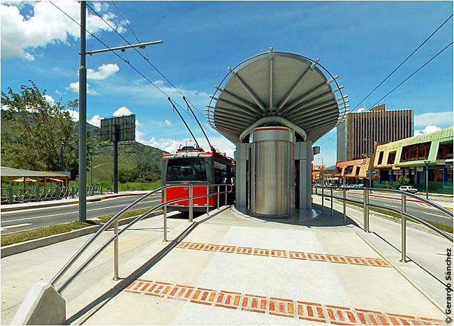
Interior of Alto Chama station [Jorge Paparoni]:
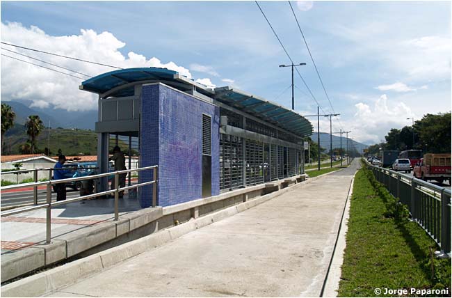
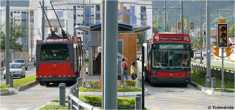
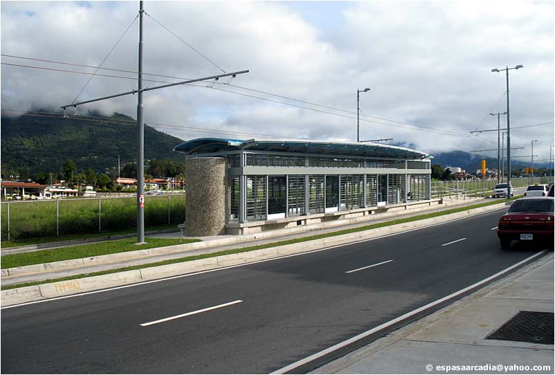
The route between Ejido and Mérida was a genuine interurban trolleybus line. This is Pan de Azúcar station [see map] [col. AM]:
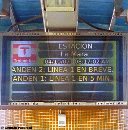
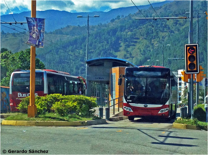
Sign at La Mara station [see map]. An eastbound trolleybus will arrive soon on platform 2; a westbound trolleybus in 5 minutes on platform 1 [Germán Paparoni]:
|
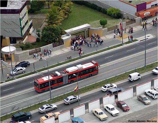
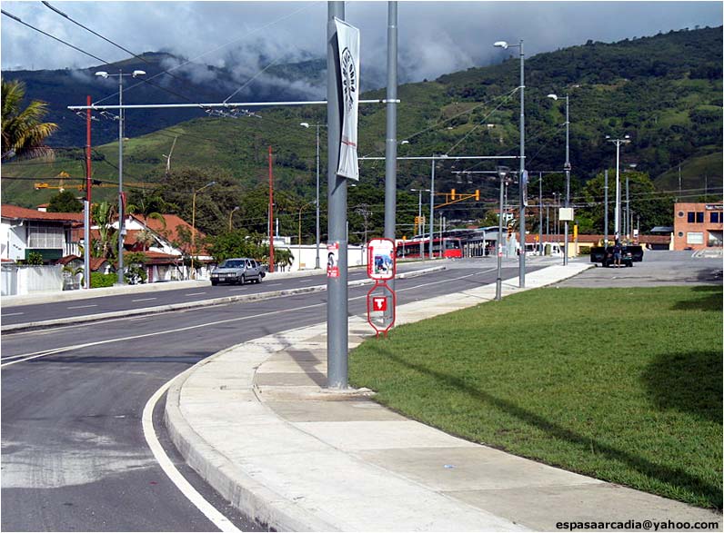
Helicopter view of Av. Andrés Bello near La Parroquia station [see map]. Note left-hand operation [Alonso Moreno]:
|

[Click here to see another, similar view.]
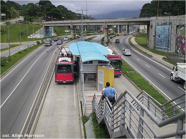
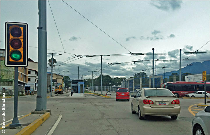
Trolmérida struggled to extend the trolleybus line from Pie del Llano station closer to the center of town. Until it arrived there the company could not charge fares. Stations were not yet been outfitted for fare collection and passengers still rode free in 2009. The original 1998 plan was to run the line down Av. Urdaneta to Plaza Glorias Patrias [see map]. But a 1999 revision moved the route to Av. 16 de Septiembre and created new problems: how to steer two contraflow trolleybus lanes through the bottleneck at Calle 53, already choked with traffic from Viaducto Sucre, and down Av. 16 de Septiembre, the busy east-west thoroughfare alongside the airport. Trolmérida solved the first problem by demolishing private homes and other structures west of Calle 53 and plowing a trolleybus path, behind houses, between Av. Andrés Bello and Av. 16 de Septiembre. The city added two automobile lanes – eastbound only – on the side. The action pleased motorists, but not residents who had been dislocated and there were angry demonstrations and numerous construction delays. The photograph below shows Pie del Llano station at the west end of the bypass – which at present is the eastern terminus of trolleybus service. The camera is facing east. Those are the automobile lanes on the right. That's Av. Andrés Bello extreme left [espasaarcadia@yahoo.com]: |
The
next picture shows the bypass from the other direction. Pie del Llano
station is in the distance. Av. 16 de Septiembre is behind the
photographer [see map]. The automobile lanes on the left are for eastbound traffic only (westbound traffic uses Calle 53) [espasaarcadia@yahoo.com]: |
Looking east on Av. 16 de Septiembre, with the airport in the background [see map].
This was formerly a 5-lane road, with curb parking and two traffic
lanes in each direction. The trolleybus reservation now occupies two
lanes and there is room only for automobiles traveling east (westbound
automobiles must use other streets). [espasaarcadia@yahoo.com]: |
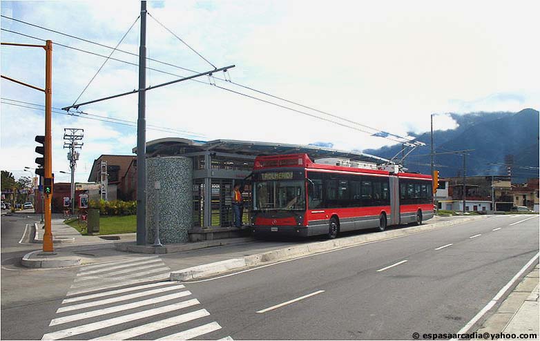
This is María Mazzarello station [see map]. Part of the airport terminal, on the other side of the airport, is visible extreme left [espasaarcadia@yahoo.com]: |
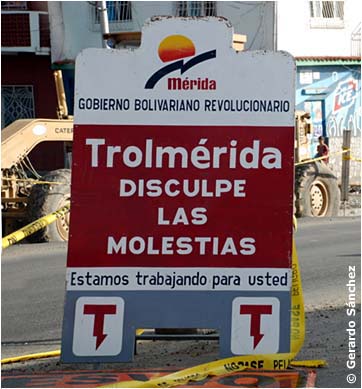
Residents found the sign below: "Pardon the disturbances" / "We are working for you" [Gerardo Sánchez]:
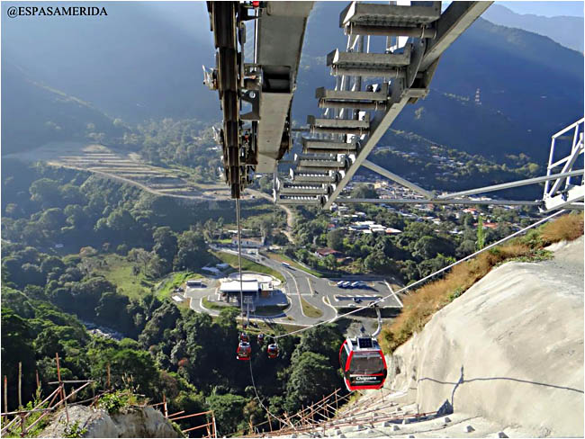
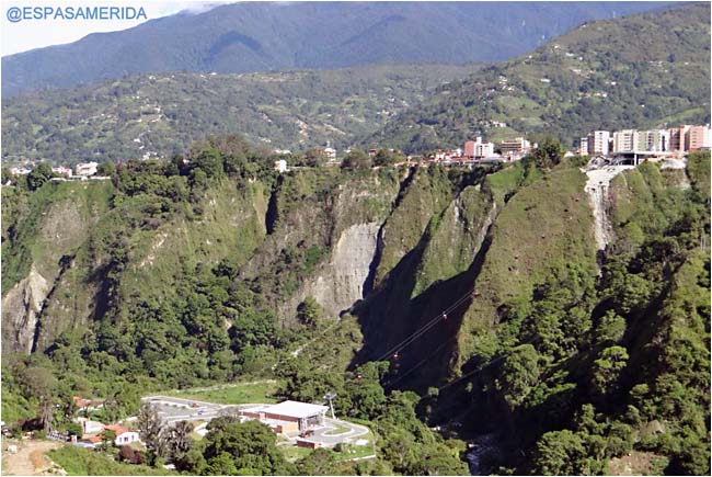
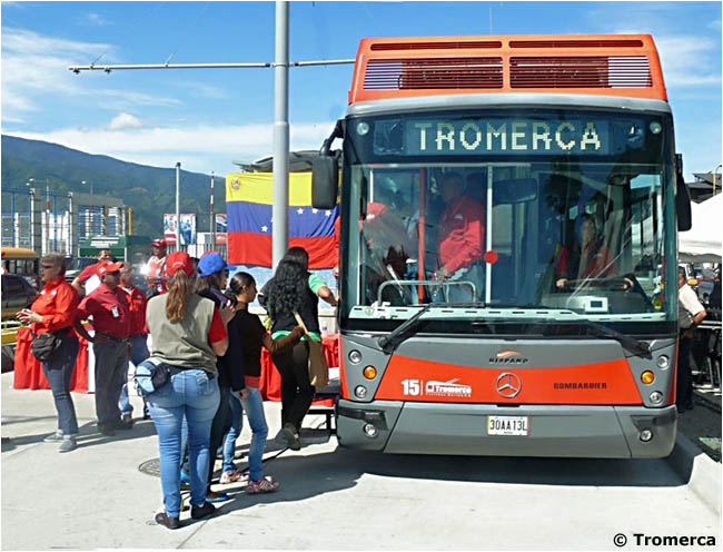
On 4 August 2009 the name of the operator was changed from Trolmérida to Tromerca (Trolebús Mérida C.A.). Construction advanced on Line 3, a teleférico [aerial cableway] from Domingo Peña trolleybus station (formerly called Los Conquistadores) down to San Jacinto in the Chama River valley [see map]. The route was originally planned as a funicular railway. Twenty telecabinas arrived from the Austrian firm Doppelmayr Garaventa on 26 August 2011. Trolleybus Line 1 was still far away, so Tromerca built a temporary terminal, an un-wired loop, near Mercado Periférico, a market complex at the east end of the airport. Trolleybuses started carrying passengers along Av. 16 de Septiembre to Mercado Periférico on 22 September 2012. They lowered their poles before entering the loop. The trolleybus line was now 13.1 km long – even though this short final section was not operated electrically [see map]. Two months later, on 26 November 2012, Tromerca announced that it had purchased 20 new diesel buses from Yutong in China to supplement the electric buses on its trolleybus line. On 15 December it inaugurated Line 3, the aerial cableway from Domingo Peña to San Jacinto [ESPASAMERIDA]:
Construction of the final segment of Line 1, a clockwise loop along Av. Tulio Febres Cordero and around the university campus to Domingo Peña terminus, began on 19 May 2014 [see map]. On 22 December 2014 – for the first time in its seven year history – the trolleybus company started charging fares. Construction of the system had always been slow – beset with countless mechanical, financial and political problems. Completion of the first 11 km, from Ejido to Pie del Llano, took seven years [see map]. Construction of the next 2 km, to Mercado Periférico, took another five years. The company was embarrassed and residents were exasperated. For whatever reason, and without previous announcement, Tromerca staged a farcical "inauguration" of the final 2 km section, between Mercado Periférico and Domingo Peña stations, on Saturday 29 August 2015. The extension still had no overhead wire and three of the four stations were not yet completed, so the trolleybuses continued to lower their poles at the airport and operate with their auxiliary diesel motors [Tromerca]:
|
|
Among its problems, Venezuela has a shortage of electricity and residents in Mérida complain of blackouts every day. Tromerca is not immune and trolleybuses began to use their auxiliary diesel motors on the entire route
in
late 2015. In 2016 the Chinese diesel buses replaced more and more
trolleybuses – even though the platforms at the trolleybus
stations were built for high-level operation and the Yutongs have low
floors. How passengers deal with this 15 cm gap is unknown [Gerardo
Sánchez]:
In
June 2016 a resident reported that he no longer saw any
trolleybuses on the line at all. Power had apparently been turned off
and the entire route was then operated exclusively, and awkwardly, by
diesel buses. Electric operation had lasted less than 10 years.
==============================
The author wishes to thank Mérida resident Gerardo Sánchez for his extraordionary assistance in the construction of this page. Without the suggestions, encouragement, information and wonderful photographs that he provided, it would never have been completed.
ALSO SEE: Gobierno Bolivariano de Venezuela. My index of If you have comments, criticism or suggestions,
This site was originally placed online on Copyright © 2009-2109 Allen Morr |