RIO DE JANEIR0
Light Rail / VLT
Allen Morrison
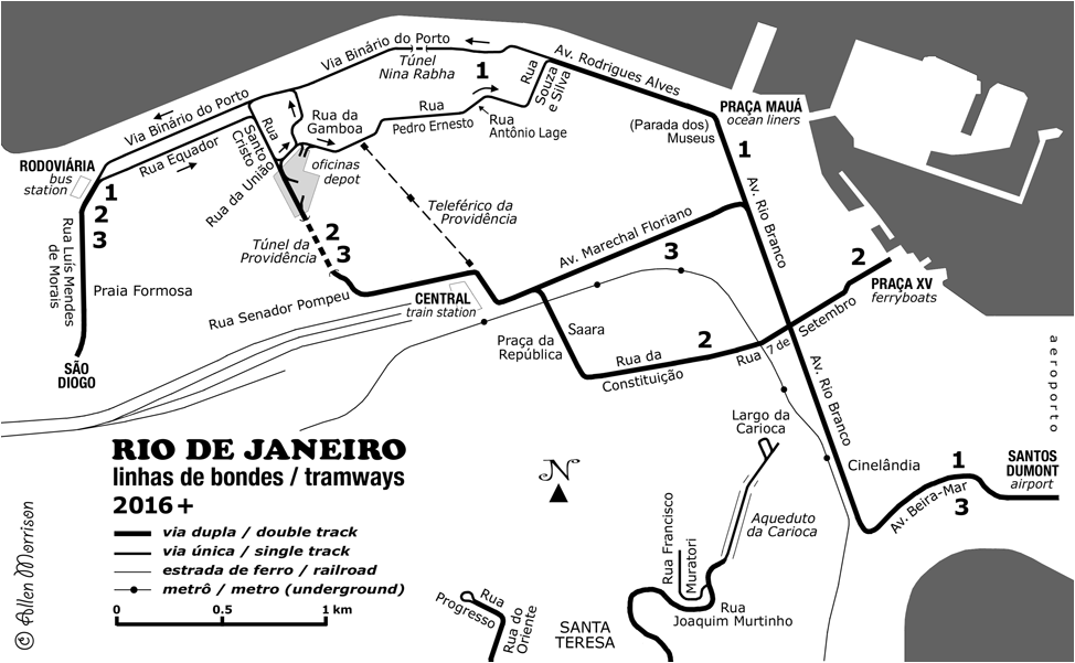
Brazil's first two light rail lines, which opened in Rio de Janeiro in 1982 and Campinas in 1993, were short-lived. The Pré-Metrô
in Rio, which used a 2-car "veículo ferroviário do tipo leve" [*] and
ran from Maria da Graça metro station to Irajá, closed in 1985. The Metrô de superfície ou VLT - Veículo Leve sobre Trilhos
in Campinas, which used the same equipment and ran from its railroad
station to Campos Elíseos, closed in 1995. Each line was about 8 km
long and each operated commercially for about two years [see Light Rail in Brazil].
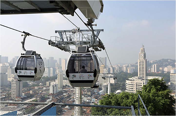
[*Term used in Projeto Básico Pré-Metrô published by the Companhia do Metropolitano do Rio de Janeiro in 1977. The term "veículo leve sobre trilhos" was not found anywhere in the book – or in newspaper reports of the 1980s. It seems first to have been used in the 1990s in Campinas.] Both those lines were built along the paths of former railroads – the E.F. Rio d'Ouro in Rio and the E.F. Sorocabana in Campinas. Rio's new light rail system is completely new and original and, for the most part, runs on paved streets – including on the city's prestigious main street, Av. Rio Branco, where trams never ran before. After Rio was chosen in 2009 to host the August 2016 Olympic Games, it began an ambitious program of reconstruction and renovation of the central, downtown area. The new "Porto Maravilha" will have 70 km of new roads, sidewalks and bike lanes, 15,000 trees, renovated water, gas, electricity and telecom networks, two tunnels, a 3-station aerial cableway, and a 28 km system of modern tramway lines. English speakers use the term Light Rail. Brazilians say VLT – veículo leve sobre trilhos – for both the vehicle and the line [see map above]. In April 2013 the Prefeitura (municipal government) signed a contract with RATP of Paris and a consortium of Brazilian companies to build, operate and maintain the tramway system for 25 years. Cost was estimated (in 2013) at USD $380 million. Alstom was selected to build the first five of 32 cars in La Rochelle, France. It is building the remaining 27 at its new factory in Taubaté near São Paulo. Downtown Rio was dismantled. The Perimetral, the elevated highway along the bay, was leveled and replaced by a 4.8 km tunnel. A sea of railroad tracks was replaced by a paved road with tram tracks. The first project to be completed was the Teleférico da Providência (aerial cableway) which began commercial operation on 2 July 2014 [see map above]. The view below is south. The tower on the right marks the train station. The hill in the distance is Santa Teresa [Rio Prefeitura]:
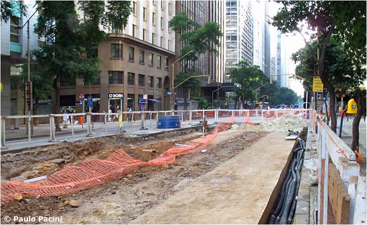
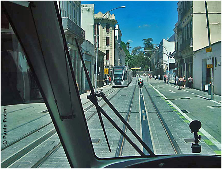
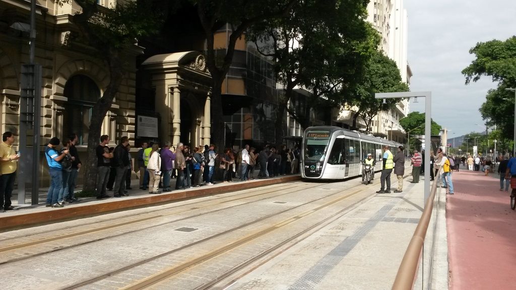
The next photograph shows early construction on Av. Rio Branco, the principal north-south thoroughfare downtown [see map]. The view is north. The VLT has stolen two automobile lanes and henceforth auto and bus traffic can only travel south on the west side of the street – and not at all, incredibly, in a six-block section in the center (see below). Trams will have double track to travel both ways on the east side [Paulo Pacini]:
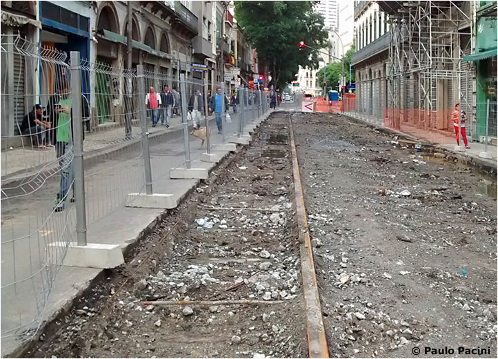
Excavating other streets like Rua da Constituição [see map] revealed the city's previous tramway system, which closed in 1967. This street is particularly interesting because when it was called Rua dos Ciganos it was the second route of the city's first tramway system, which closed in 1866 (the original 1859 line ran a block south: see First Tramway Maps). Trams will return to the street that they left twice in the past [Paulo Pacini]:
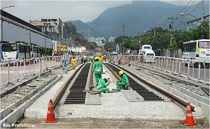
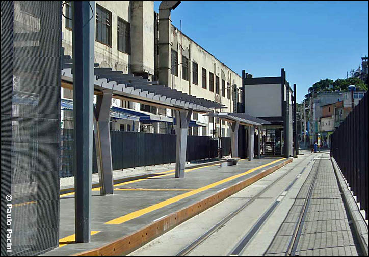
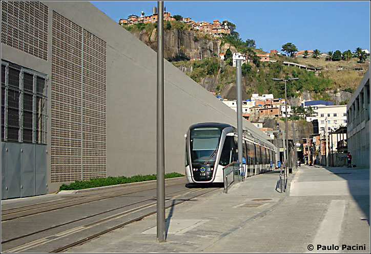
The following picture shows Rua Luís Mendes de Morais at the west end of the system. The photographer was facing south. Track gauge of the light rail line is standard 1435 mm. Rio's metro and railroad lines use 1600 mm gauge [Rio Prefeitura]:
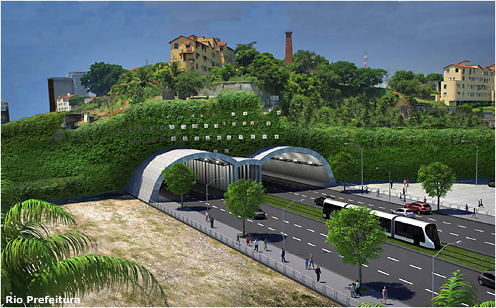
An artist's rendition of the Túnel Nina Rabha (also known as Túnel da Saúde) [see map]. It has a single track for the westbound VLT (which should have seven sections, not four). View is east [Rio Prefeitura]:
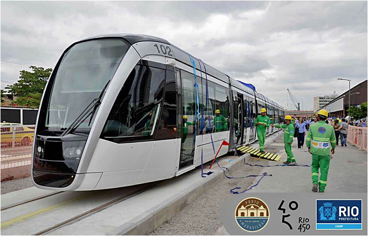
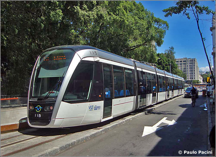
Rio's first VLT finally arrived from France on 26 June 2015 and appeared a week later on Rua Luís Mendes de Morais, near the bus station. The view is north – reverse of the scene above. Each of the 32 vehicles will be 44 m / 144 ft long and able to carry 420 passengers [Rio Prefeitura]:
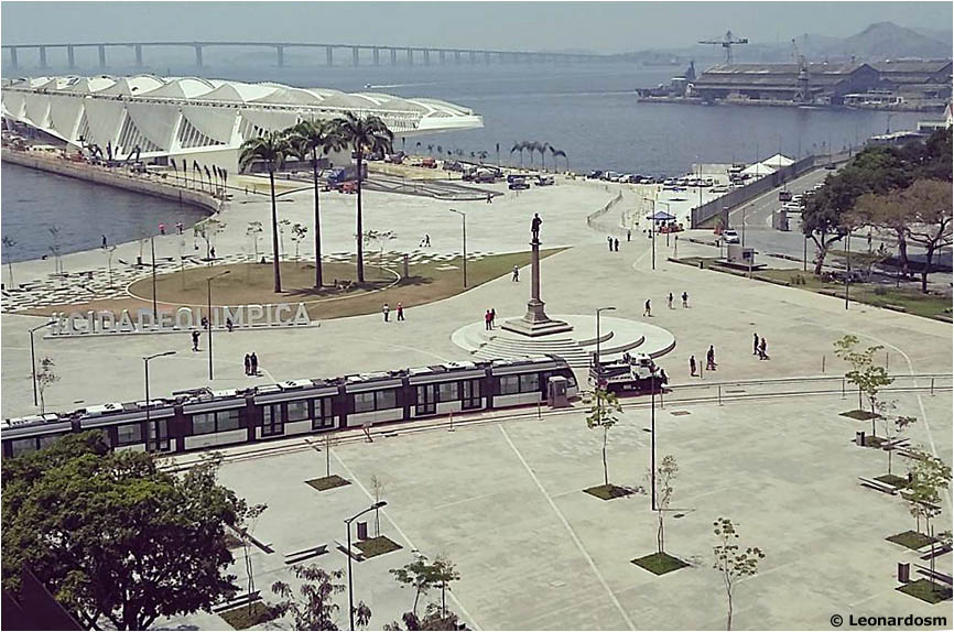
Instead of overhead wires or simple center rail, Rio's VLT uses a unique form of Alstom's APS system [alimentação pelo solo]. In the Prefeitura's words: "...O abastecimento energético do VLT se dará por meio de um sistema único que consiste na combinação de um terceiro trilho, localizado nas paradas e em certos trechos da linha, e de um supercapacitador que utilizará a energia produzida em cada frenagem que, armazenada, poderá impulsionar os trens do sistema" (The VLT's energy supply will be through a unique combination of a third rail located at stops and in certain sections of the line and a supercapacitor that will store the energy produced when the car brakes and use it to power the system's vehicles). During the night of 15 October 2015 a truck towed VLT 104 from the Rodoviária area to Praça Mauá [see map]. This photograph was taken the next morning. The large white structure is the Museu do Amanhã [Museum of Tomorrow], designed by Santiago Calatrava, who also designed the new World Trade Center station in New York ["Leonardosm"]: |
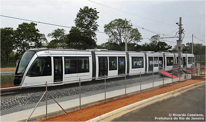
A
week later, on 21 October, Alstom tested the first of 27 VLTs that it
is building for Rio de Janeiro at its new factory in Taubaté in São
Paulo state. (The first five VLTs came from its factory in France.)
Note that the paint pattern on 106 is slightly different [Ricardo
Cassiano, Prefeitura do Rio de Janeiro]:
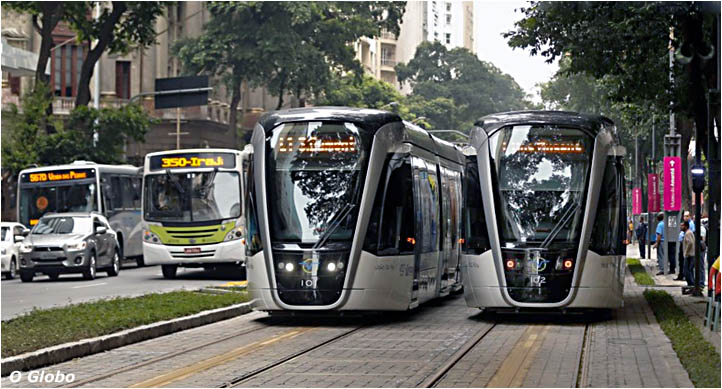
On 28 February the Prefeitura began running VLTs, without passengers, from Praça Mauá to Cinelândia and announced plans for a 23 km extension of the system to Gávea, a residential area near the ocean. Finally, on Sunday 5 June, passengers were allowed to ride the VLTs, free of charge, from Parada dos Museus to Santos Dumont Airport [see map] [O Globo]: |
Service
at first was only from noon to 3 pm, but schedules quickly expanded.
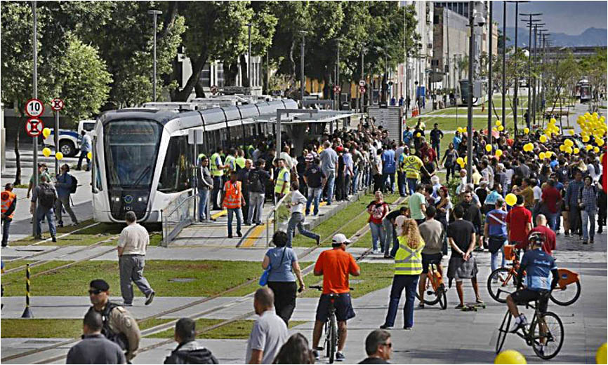
Concurrent with the transport inauguration, the Prefeitura dedicated
its new promenade along Av. Rio Branco – a six-block pedestrian mall
between Cinelândia and Av. Nilo Peçanha [near Rua 7 de Setembro on the
map]. No automobiles, no buses, just people and VLTs in the city center
[Governo Federal sobre os Jogos Olímpicos]:
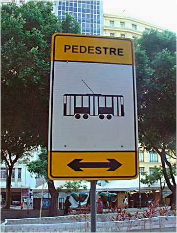
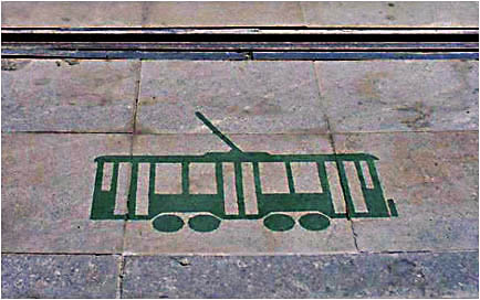
The vehicle doesn't look very much like a VLT, but the sign was no doubt made before the new vehicles arrived ["acpinto"]:
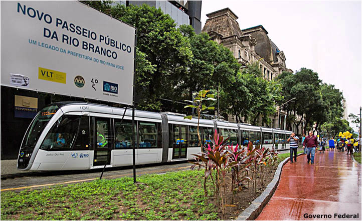
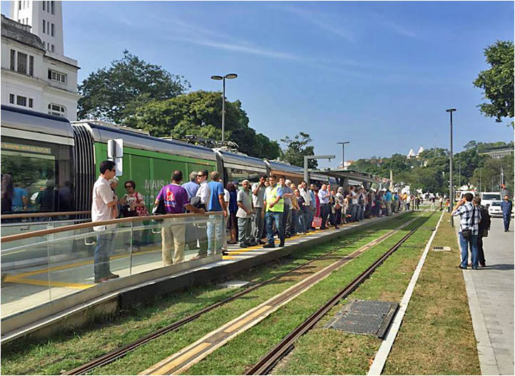
Passengers wait to board a VLT in the promenade section of Av. Rio Branco ["urbanoaposentadorio"]:
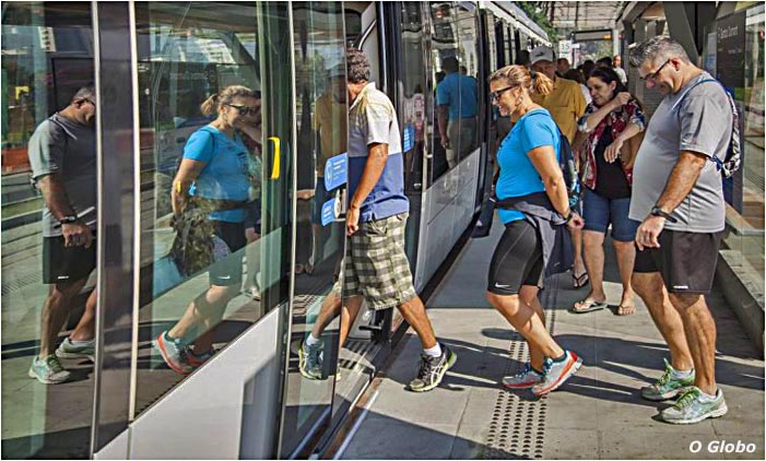
Access is easy with curb-level loading [O Globo]:
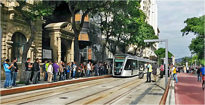
Pedestrians and VLTs share 0.7 km of Av. Rio Branco. Many have not yet adjusted to walking in the street [link]:
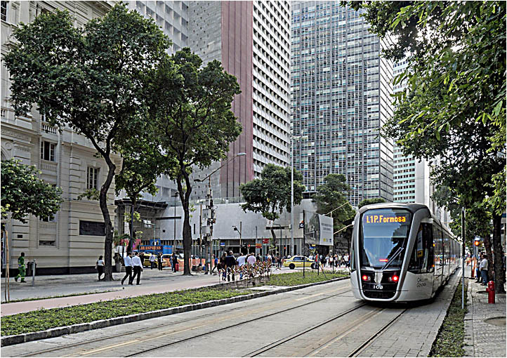
This VLT was headed north on "L1" (Linha 1) to Praia Formosa [see map]:
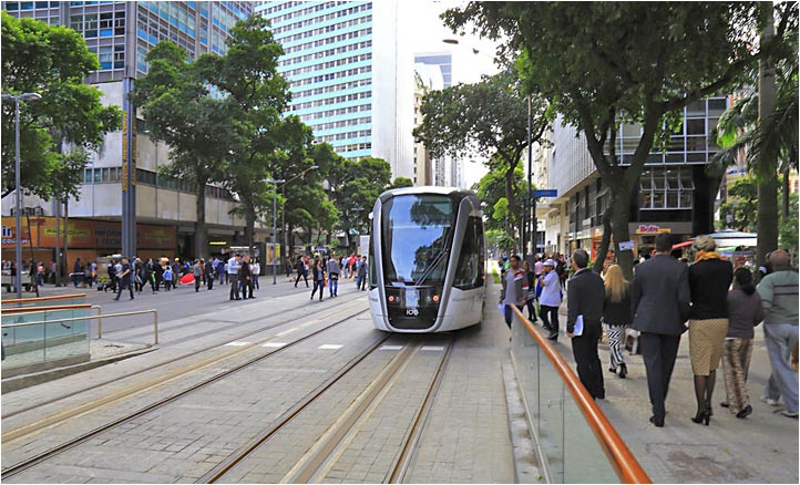
On the section of Av. Rio Branco north of the pedestrian mall, automobiles and buses travel south – and south only – on the west side. VLTs travel in both directions on the east side. The photographer was facing north [O Globo]:
The same drawing in the pavement ["acpinto"]:
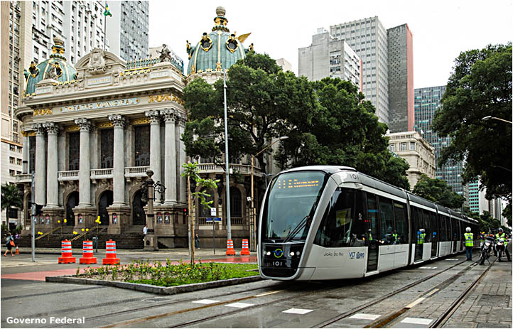
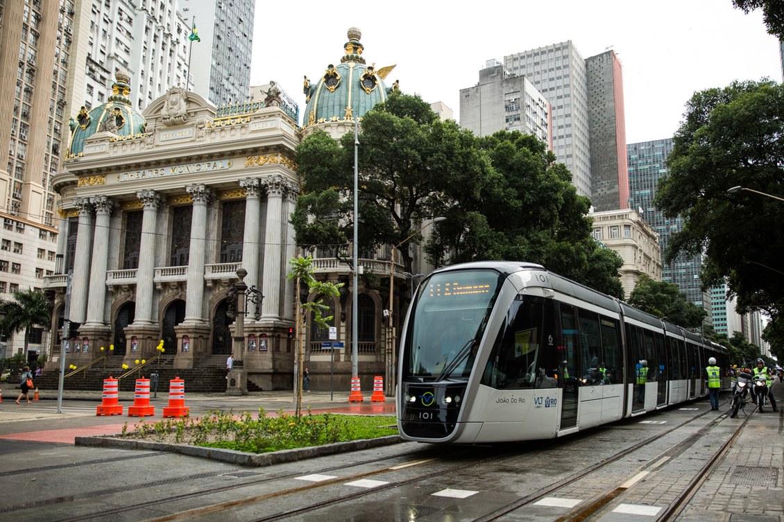
Rio's magnificent Theatro Municipal (opera house) on Av. Rio Branco near Cinelândia [Governo Federal sobre os Jogos Olímpicos]:
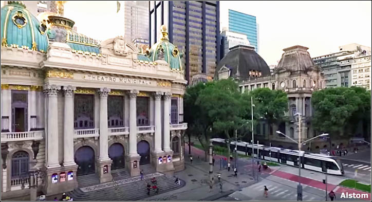
The same scene viewed from the Câmara dos Vereadores (City Council building) across the way [Alstom]:
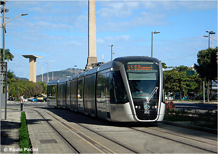
This photograph illustrates the difficulty of capturing the words on the VLT rollsigns. If the split second exposure of the camera does not match the flickering of the sign, this will be the result. The obelisk commemorates the inauguration in 1905 of Av. Central – which was renamed Av. Rio Branco in 1912 [Paulo Pacini]:
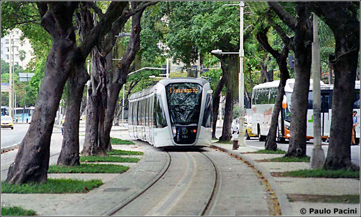
Because they don't need overhead wires for power, Rio's VLTs can easily navigate tree-lined Av. Beira-Mar [see map]:
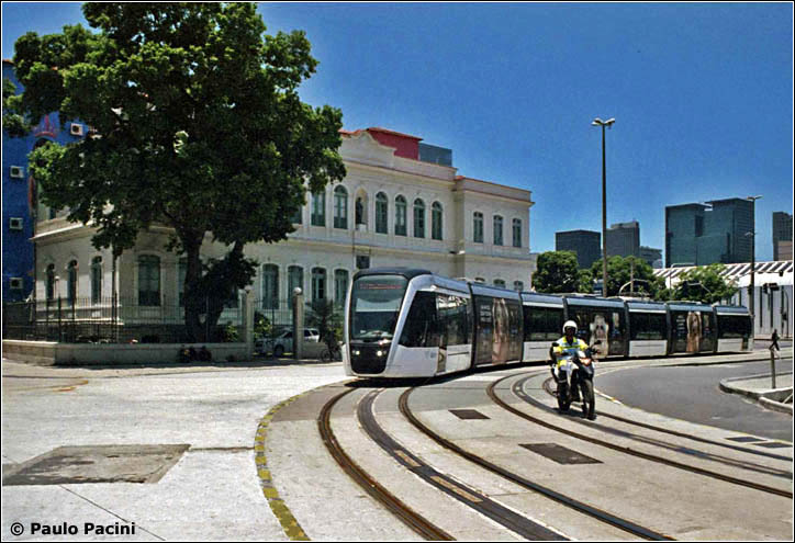
On 12 July 2016 seven VLTs began carrying passengers along the entire 10 km route from Santos Dumont airport to Rodoviária bus station. Frequency was only every 15 minutes because the vehicles had (temporarily) to run in both directions on the single track on Via Binário do Porto [see map]. The eastbound route via Rua Pedro Ernesto was still not operative. Here is the Parada dos Museus near the end of Av. Rodrigues Alves. View is east, toward Praça Mauá. Passengers are waiting for a VLT headed to Santos Dumont [photographer unknown]:
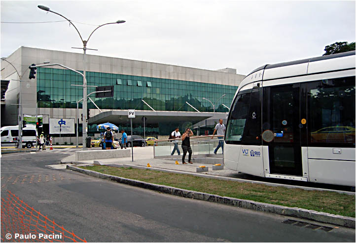
VLTs terminate opposite the new departures building at Santos Dumont Airport (the arrivals building is out of sight on the left). "FV" possibly means Fim da Via (End of the Track) [Paulo Pacini]:
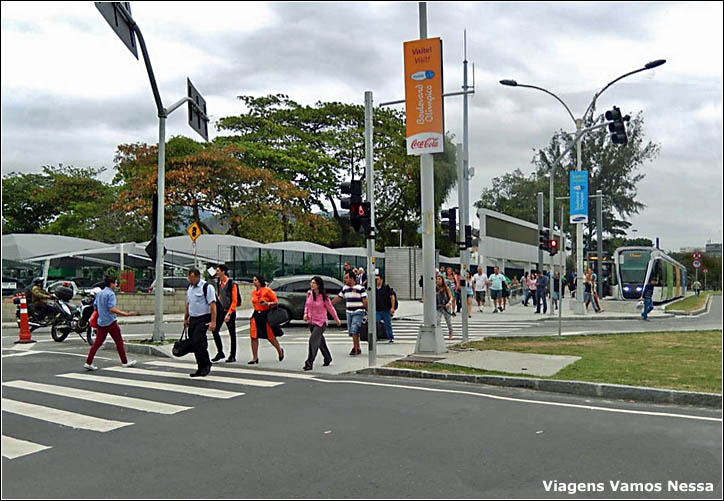
Reverse
view of the scene above. Passengers arriving on the VLT head for the
departures building across the street. The crosswalk is protected by traffic lights [Viagens Vamos Nessa]:
A westbound VLT crosses Praça Mauá at dusk ["akamaihd"]:
On
6 February 2017, after several months of testing, VLTs began providing
free rides on a 2 km section of L2 (Linha 2), between the ferryboat
terminal at Praça XV and Saara station on Praça da
Rebública [see map]. The glass building in the background is
reflecting the structure on the right [Paulo Pacini]:
|
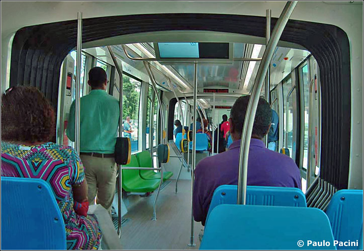
The picture below, taken on 23 March 2017, shows the Praça XV terminus. The photographer was facing east, toward the bay [Antonio Giacomelli]: Loading at Praça XV. Since only a short section of the line was involved, the banner announces not an inauguration but only the "Início da Operação da 2° Fase do VLT Carioca" [Paulo Pacini]: 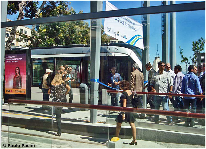 Interior of a VLT on 6 February 2017 [Paulo Pacini]:
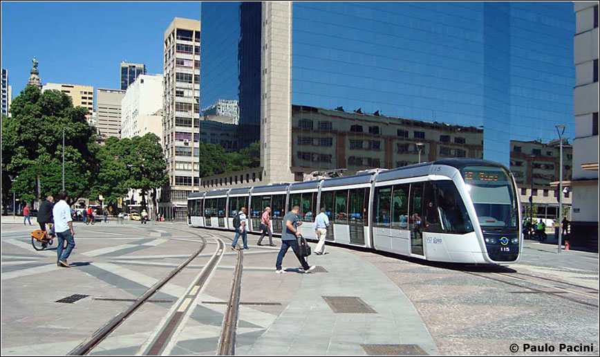
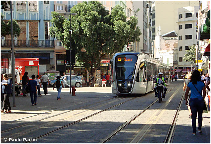
The train
proceeds west from Praça XV toward the "jog" onto Rua 7 de
Setembro [see map]. The handsome white building at the corner of Av.
Primeiro de Março is the Convento do Carmo [Paulo Pacini]:
The
view east on Rua 7 de Setembro. A policeman on motorbike precedes each
VLT to keep other vehicles off the reserved lanes [Paulo Pacini]:
Rua da Constituição, approaching Praça da República. This was precisely the route of Brazil's first street railway, inaugurated on 30 January 1859 [see third picture at the top of this page and also First Tramway Maps] [Paulo Pacini]:
Saara,
on Praça da República, was the first, temporary terminus
of L2 [see map]. "Saara" is an acronym of Sociedade de
Amigos das Adjacências da Rua da Alfândega, a popular open-air
market on streets nearby.
On
21 October 2017 Linha 2 was finally extended from Saara to Central
train station and then under the mountain to the port area and
Rodoviária bus station
[see map]. In the photograph below a VLT curves in front of Escola
Rivadávia Correia onto Av. Marechal Floriano [See view of the school in 1900] [Paulo Pacini]:
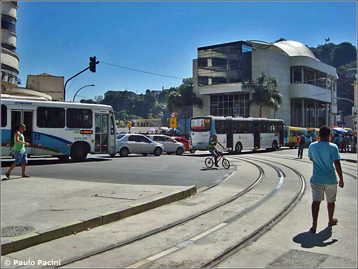
Praça Cristiano Otoni in front of the train station
is a congested area of automobiles, buses, bicycles and pedestrians,
and also the location of Providência teleférico
station, shown below. Its windows reflect a rounded corner
of Central train station, just out of view on the left. The tracks lead
to Central VLT station [Paulo Pacini]:
Central
VLT station is squeezed between the north side of Central train station and
Providência mountain. The picture below was taken before VLT service
had begun [Paulo Pacini]:
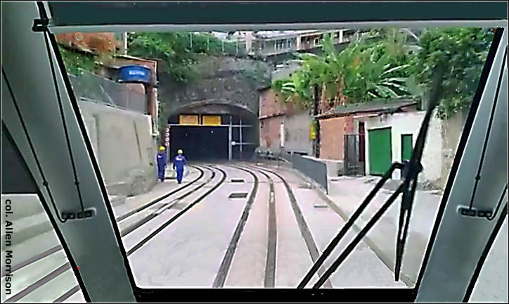
A short distance beyond the train station L2 enters the Túnel da
Providência for a quick double-track path to the bus station [see map]. Visitors are advised not to walk in this area [col. AM]:
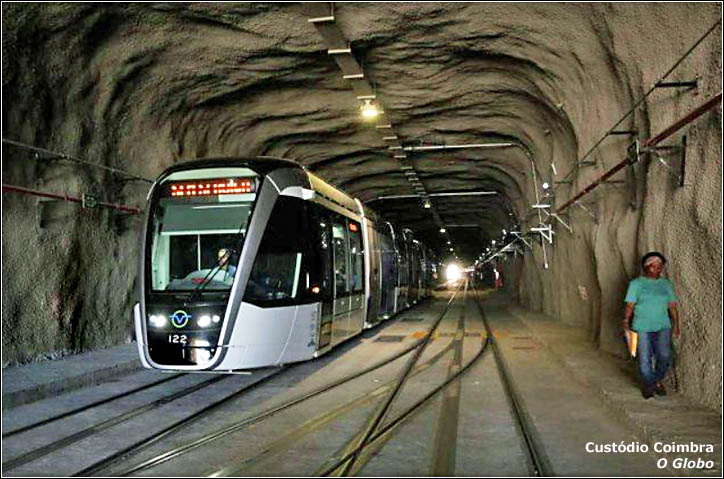
Until recently the Túnel da Providência was a railroad tunnel called Túnel da Marítima that was used by freight trains. Length is 315 m = 1034 ft. It was deactivated in 1994 and sat abandoned for 20 years [Custódio Coimbra, O Globo)
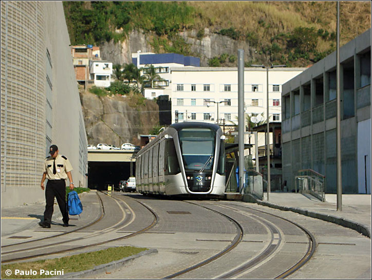
Here is the north portal of the tunnel [see map]. The photographer was facing south on Rua Santo Cristo [Paulo Pacini]:
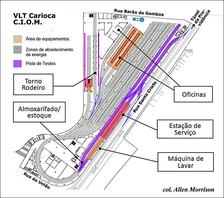
This
wider view of the same location reveals the 800 ft = 250 m western wall of the "C.I.O.M." – Centro Integrado de
Operação e Manutenção do VLT Carioca – the system's
offices, garage and shops [Paulo Pacini]: The
diagram shows what's inside. The 32 VLTs access the C.I.O.M. either at the tunnel
portal, shown above, or in the middle of the Pista de Testes (test track, in blue) on Rua Santo Cristo [col. AM]:
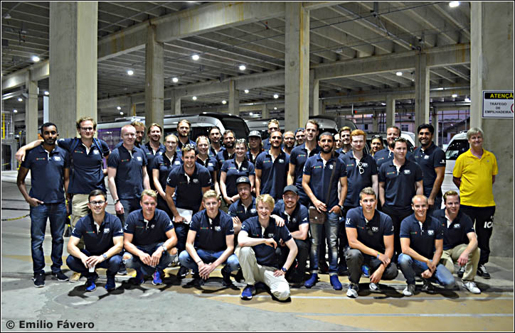
In
September 2017 36 engineering students from Lulea University of
Technology in Sweden visited the VLT Carioca and posed inside the
shops. The city's extraordinary new transport system attracts
engineers not only from other Brazilian cities but from every part of
the world. Note the overhead wires, used only for
maneuvers within the C.I.O.M. [Emilio Fávero, courtesy Luiz Ecard and Caio Lobo]:
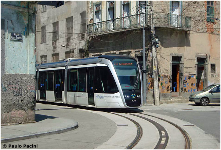
Beyond the C.I.O.M. the airport-bound VLTs of L1 pass briefly through a rough, neglected part of town, which is one
of its oldest districts. The photograph shows VLT 105 turning from Rua
da Gamboa onto Rua Pedro Ernesto [see map]. Note that, in addition to
fleet numbers, Rio's VLTs also display the names of its favorite sons,
in this case the novelist, poet and playwright Machado de Assis [Paulo
Pacini]:
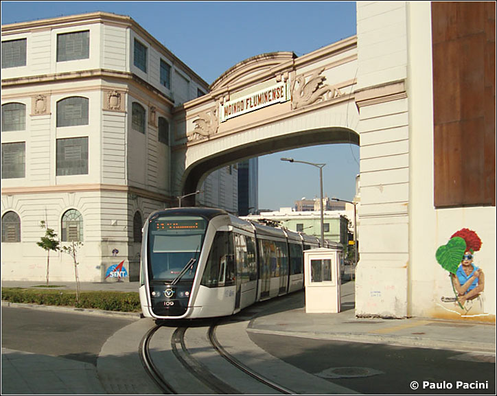
Farther east, the single-track line pierces the grounds of the
abandoned Moinho Fluminense mill. VLT 109 was leaving Rua Antônio
Lage and traveling away from the camera, toward Santos Dumont airport, on 9 August 2017. There is a plan to convert the mill complex into a shopping center [see map] [Paulo Pacini]:
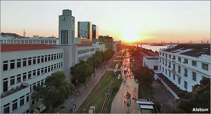
Av. Rodrigues Alves along the harbor [see map] was once lined with freight railroad tracks and an ugly elevated highway. The highway has been moved underground and the avenue is now a grassy mall with VLT tracks for Linha 1 [Alstom video]:
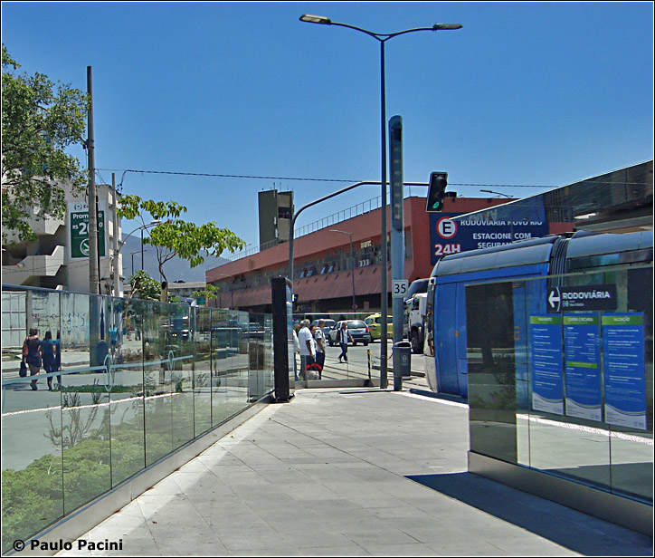
A
VLT arrives at the Rodoviária VLT station, at the corner of Via
Binário do Porto and Rua Equador [see map]. The station posters make the vehicle look blue; it is not. That's the Rodoviária bus terminal on
the other side of the street. The platform for VLTs headed back to the city is just out of view on the left [Paulo Pacini]:
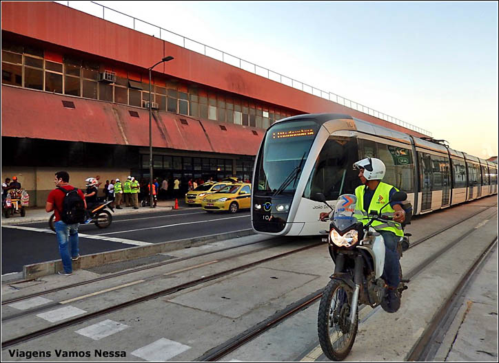
A reverse view of Rodoviária Novo Rio, where travelers arrive from – and
depart for – other cities in Brazil [see map]. As usual, a
policeman tries, not always successfully, to keep pedestrians and other
vehicles off the tracks [Viagens Vamos
Nessa]:
On 2
December 2017 the western terminus of lines 1 and 2 was extended from
Rodoviária bus station to Praia Formosa on Rua Luís
Mendes de Morais [see map].
To be continued... / Continua... See Rio's first VLT line 1982-1985
Also see Rio Tramway History 1859-1967 and my general index of If you have comments, criticism or suggestions, please send an email to Allen Morrison This page was first uploaded on 14 July 2015 It was replaced by an updated version on 8 February 2017 Copyright © 2015-2115 Allen Morrison Todos os Direitos Reservados |